
Start with the operational questions
Consider a regional maintenance team serving several customer sites. A supervisor needs to know which vehicle can reach the next job, whether the equipment trailer has arrived, and where a generator was last reported. These different questions belong to the same daily operation.
Before selecting trackers, agree what each team needs to see. Is a recent location enough, or does dispatch need frequent updates? Does powered equipment need activity information? Who should review an alert when an asset leaves its allocated site? Defining the decision helps avoid collecting data that nobody uses.
Give every asset a consistent identity
Start with the existing asset register. Link each tracking device to a stable asset ID, registration where applicable, asset type and allocated site. Keep those identifiers consistent when an asset moves between locations or a tracker is replaced. A familiar name makes a map marker useful to the team managing the work.
Assigned drivers and responsible teams should come from agreed business records or a configured assignment process. A location signal alone cannot identify who is driving. Keeping assignments current is as important as receiving a new position.
Match the information to the asset
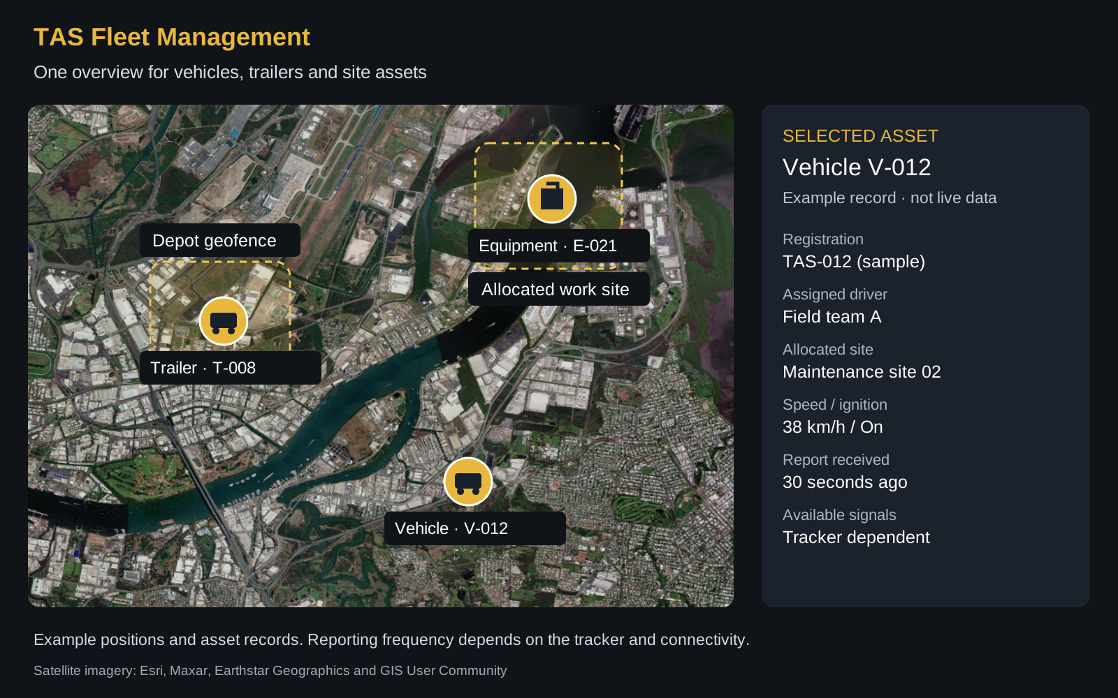
Vehicles can provide location and, with a suitable connected tracker, speed, ignition status and engine-hour information. Confirm the source and meaning of each field: ignition-on duration is not automatically measured engine running time. Additional vehicle information requires an appropriate device and interface.
Unpowered trailers and movable equipment may use battery-powered trackers with a different reporting interval. A parked trailer does not need the same update pattern as a dispatched vehicle. Power, connectivity and configuration affect what arrives and how often. TAS can help select and provide suitable trackers for the agreed deployment.
Always show when a position was last received. A last-known location is useful, but it should not look like a fresh live update. If a signal is unavailable, show it as not supplied rather than zero. This prevents a missing speed reading from being mistaken for a stationary vehicle.
Use sites and geofences to add context
Connect assets to their allocated depots and work sites. Geofences can help teams review arrivals, departures and assets reported outside an expected area. Combine those events with timestamps and planned work before deciding whether follow-up is needed.
A trailer leaving a depot may be an expected delivery. Equipment still reported at yesterday’s site may need collection or simply a fresh update. An event is a prompt to investigate, not proof of a problem. Give dispatchers, site teams and managers access appropriate to their responsibilities.
Connect existing business records
An existing asset database can supply identifiers, types and site allocations through agreed interfaces. HR or identity systems can support user records, access roles and driver assignments where those fields are available. Define which system owns each field and how changes are synchronised.
TAS Fleet Management provides a configured overview of supported tracking information. Where ground assets and aerial operations share a site, an agreed connection with SkyStream can keep site context consistent. Integration scope, supported trackers and available signals should be confirmed for the deployment.
Build a useful daily review
At the start of a shift, check asset availability, reporting freshness and assignments. During the day, use the map and asset details to coordinate collections, deliveries and site activity. Review unexpected movements with the responsible team, then record follow-up in the organisation’s existing work process.
At the end of the week, look for recurring issues: assets missing fresh reports, unclear assignments or equipment waiting at a completed site. If measuring utilisation, define the period, eligible assets and what counts as activity. Comparable records support better decisions; a map alone cannot prove productivity or savings.
Further reading
For background on differing tracking needs, see Geotab’s asset tracking guide and Samsara’s GPS fleet tracking overview. These describe broader industry approaches; TAS support is agreed for your selected devices and configuration.
Explore the TAS fleet view
See how asset locations, sites and supported telemetry come together, then discuss the requirements of your own fleet.
Explore Fleet Management